Gulf of Guinea
São Tomé IslandLocation, Map & Geography
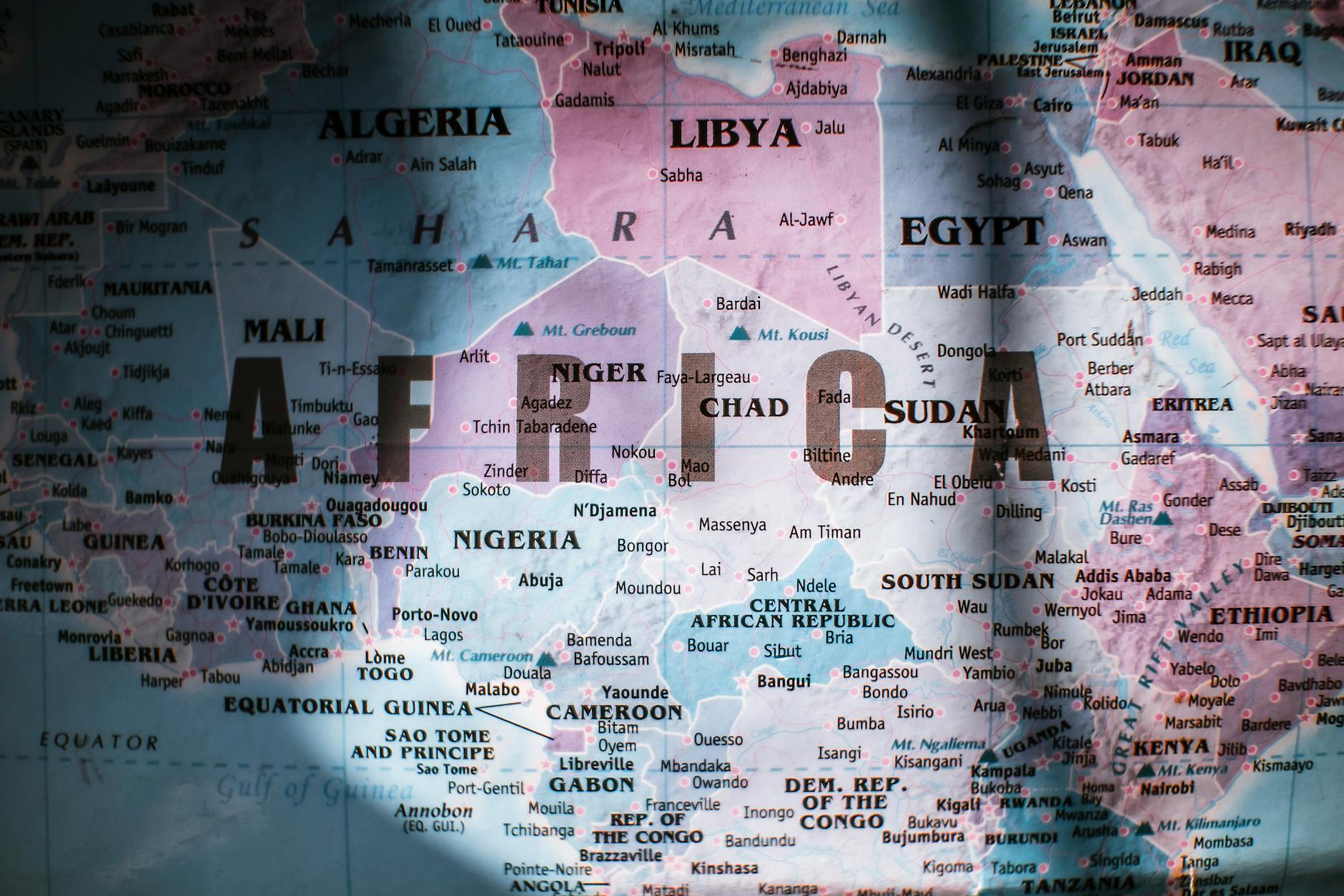
São Tomé sits almost exactly on the equator in the Gulf of Guinea, around 250 kilometres off the west coast of Gabon. Volcanic, heavily forested, and largely untouched by mass tourism.
São Tomé is the larger of the two main islands that make up the Democratic Republic of São Tomé and Príncipe, a small country in Central Africa. It sits almost exactly on the equator in the Gulf of Guinea, around 250 kilometres off the west coast of Gabon. The island is volcanic, heavily forested, and ringed by black sand beaches in the north and golden sand in the south. Most of it remains untouched by mass tourism.
This page covers the basics: where São Tomé is on the map, what the São Tomé and Príncipe flag looks like and what it means, the capital, population, geography and climate. If you came here looking for what to do, where to stay or how to get here, the links throughout point to the relevant pages.
Where is São Tomé and Príncipe?
Where is São Tomé? The island sits in the Gulf of Guinea, just north of the equator, at approximately 0° 12' N and 6° 39' E. The nearest mainland is Gabon, with Libreville roughly 300 kilometres to the east. Equatorial Guinea lies to the north-east and Angola to the south.
The country of São Tomé and Príncipe consists of two main inhabited islands, São Tomé and Príncipe, plus several smaller islets including Ilhéu das Rolas, which is bisected by the equator itself. São Tomé is the larger island and home to the capital city and most of the population. Príncipe lies about 140 kilometres north-east of São Tomé and has its own distinct character.
São Tomé in Africa is sometimes miscategorised as West Africa. Located in Africa's Gulf of Guinea, São Tomé and Príncipe is geographically and politically part of Central Africa, not West Africa. The country is a member of the Economic Community of Central African States.
São Tomé and Príncipe Map
São Tomé Island measures roughly 50 kilometres from north to south and 30 kilometres at its widest point, covering 859 square kilometres. The island is shaped a little like a pear, with the capital and the bulk of the population in the flatter, drier north, and the wild, wet, mountainous south rising into rainforest interior.
The main road runs as a loop around the coast. There is no road that crosses the centre of the island. The interior is dominated by the Obô Natural Park, a protected rainforest reserve that covers around 30 percent of the country. Pico de São Tomé, the highest point at 2,024 metres, sits inside the park and is rarely climbed.
For a São Tomé map broken down by travel region, see the Regions of São Tomé page. To see São Tomé and Príncipe on a map, the islands appear as two small dots in the Gulf of Guinea off the west coast of Gabon.
São Tomé and Príncipe Capital
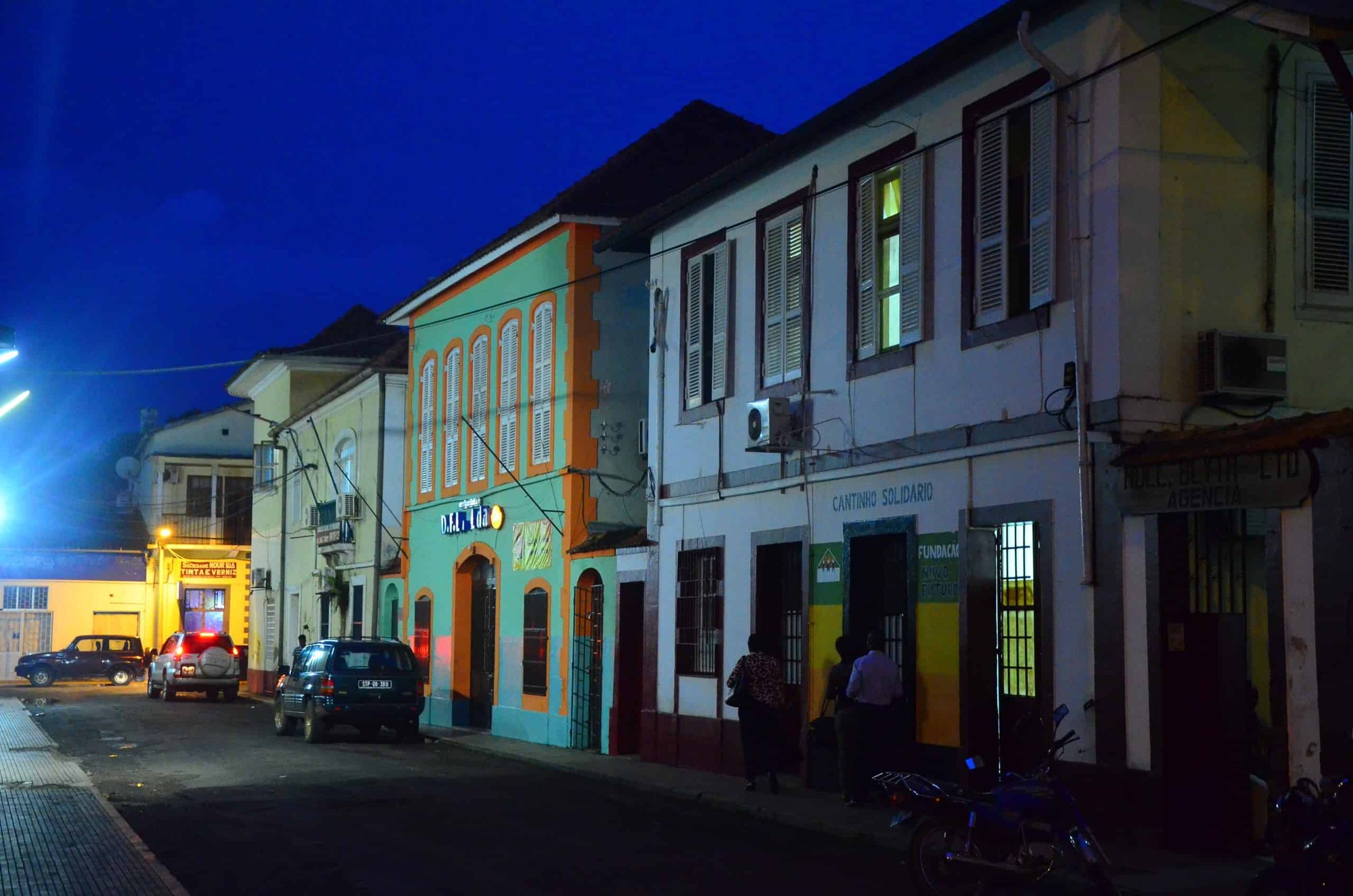
The São Tomé and Príncipe capital is São Tomé city, located on the north-east coast of São Tomé Island. It is the only city of any size in the country. Around a quarter of the country's total population lives in or immediately around the São Tomé capital.
The city is small, walkable in a morning, and built around the natural harbour where Portuguese settlers first established a colonial outpost in the late fifteenth century. Colonial-era buildings, a working covered market, the sixteenth-century Fort São Sebastião and the cathedral give the centre its character.
For a full guide to the capital, see the São Tomé City Guide.
São Tomé and Príncipe Flag
The flag of São Tomé and Príncipe was adopted on 5 November 1975, when the country gained independence from Portugal. It uses the Pan-African colours of green, yellow and red, arranged in three horizontal bands with a red triangle on the hoist side and two black stars in the central yellow band.
The São Tomé flag colours and symbols carry specific meaning:
Green
Represents the vegetation that covers most of the islands
Yellow
Stands for the equatorial sun and historically for cocoa
Red
Represents the struggle for independence
Two Black Stars
Represent the two main islands and African heritage
São Tomé and Príncipe Population and People
The São Tomé and Príncipe population is approximately 230,000 people, making it the second smallest country in Africa by population after Seychelles. The São Tomé population grows at a steady rate of around 1.6 percent a year.
São Tomé Island accounts for the great majority, with around 200,000 residents. Príncipe has roughly 8,000. The São Tomé and Príncipe people are overwhelmingly young, with a median age of around 19 years.
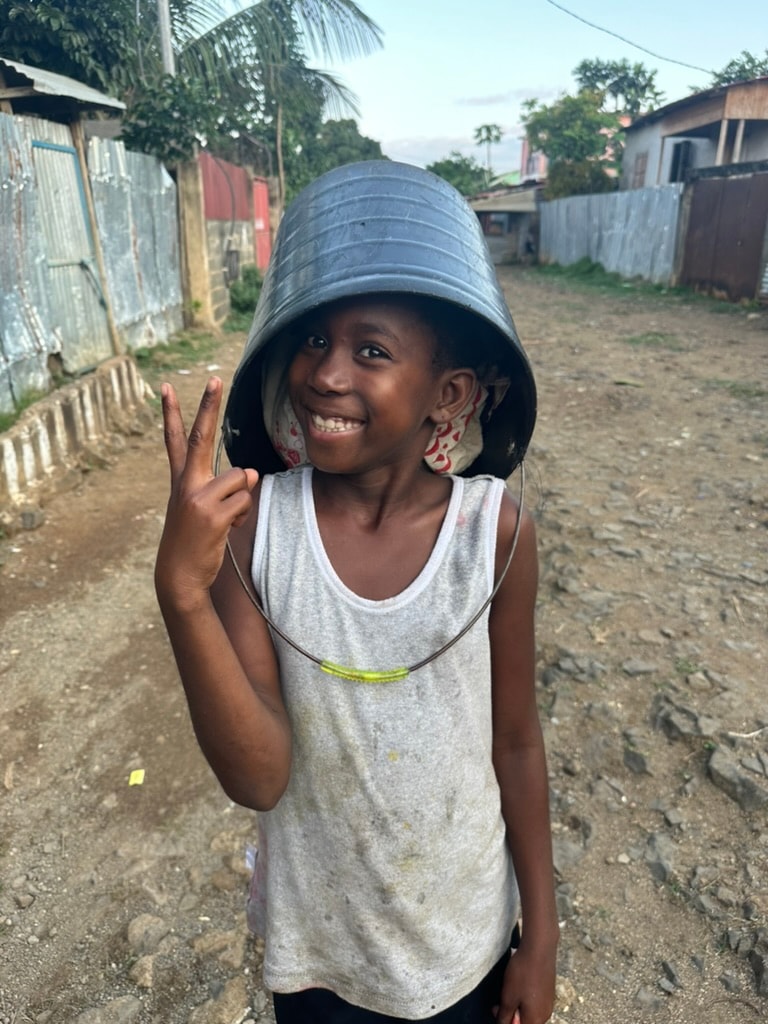
The people of São Tomé and Príncipe are descended from a mixture of Portuguese settlers, enslaved Africans brought during the sugar and cocoa eras, and contract labourers from Cape Verde, Angola and Mozambique. The São Tomé people share a distinct Santomean creole culture that is neither fully African nor European but something specific to the islands.
Citizens are known as São Toméans or Santomenses. The pronunciation of São Tomé is roughly "sow toe-MEH" and Príncipe is "PRIN-see-puh".
São Tomé Geography and Terrain
São Tomé is volcanic in origin, part of a chain of seamounts and islands stretching south-west from Cameroon into the Atlantic. The islands are the eroded remnants of ancient volcanoes that have been extinct for millions of years.
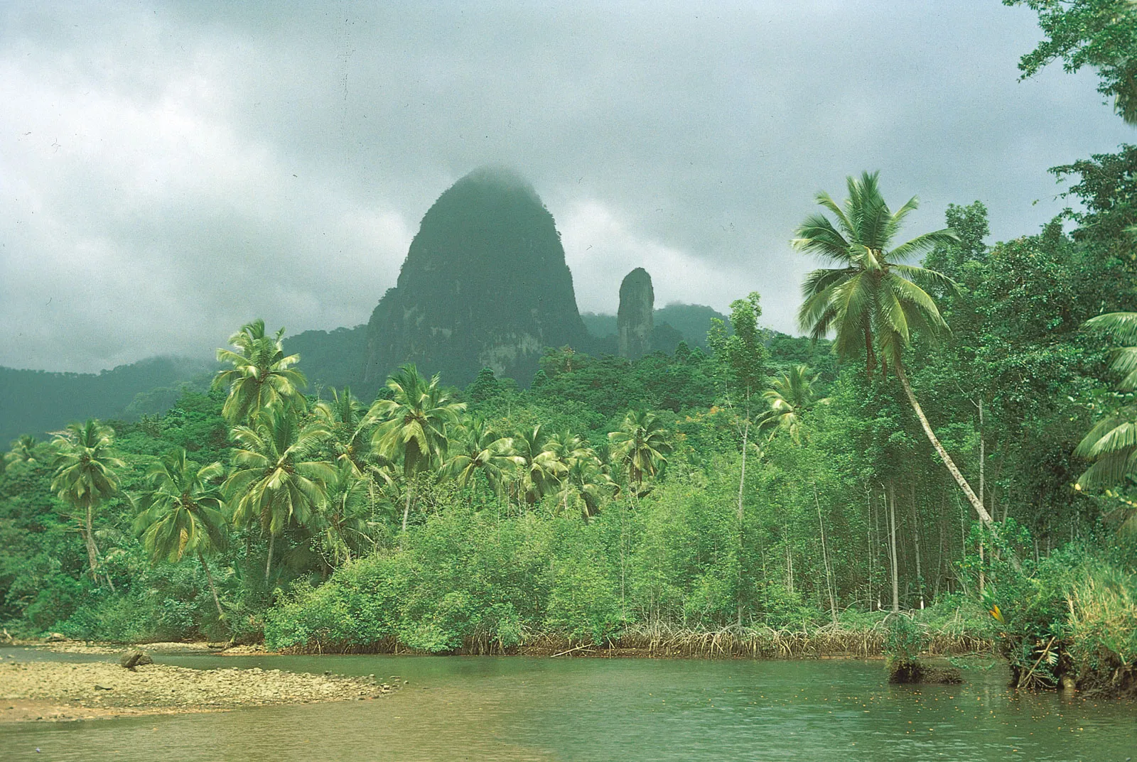
The terrain is dramatic. The north of São Tomé is flatter, drier and dotted with the ruins of old plantation houses known as roças. The centre rises sharply into rainforested mountains. The south is wet, wild and densely forested, with rivers cutting deep valleys down to the coast.
The signature feature of the southern interior is Pico Cão Grande, a needle-like volcanic plug that rises 663 metres almost vertically out of the rainforest. It is one of the most photographed landmarks on the islands.
The coastline alternates between long stretches of dark volcanic sand in the north and pale golden beaches in the south. Coral reefs, mangroves and protected bays give the islands some of the best and least crowded diving in West and Central Africa.
São Tomé Weather and Climate
São Tomé weather is tropical equatorial, stable year round, ranging from around 22°C at night to 30°C in the day, with high humidity. The São Tomé climate has no true seasons in the temperate sense, but there are two distinct periods:
Dry Season (Gravana)
June to September
Skies are clearer, the sea is calmer and the islands are at their most accessible.
Wet Season
October to May
Heaviest rainfall between February and April. Rain tends to come in short heavy bursts rather than continuous downpour.
The south of the island is significantly wetter than the north year round, which is why the southern rainforest is so dense. For a full breakdown of when to come and what to expect, see the Best Time to Visit São Tomé page.
São Tomé and Príncipe Currency, Language and Time
Currency
The dobra (STN). Euros widely accepted. Cash is essential outside the capital. See currency guide.
Language
Portuguese is official. Forros, Angolar and Lung'Ie are local creoles. English is limited to hotels and tour operators.
Time Zone
GMT (UTC+0) year-round. No daylight saving.
São Tomé Airport and How to Get There
São Tomé International Airport (TMS), just outside the capital, is the only international airport in the country. The São Tomé and Príncipe airport sits roughly 7 kilometres from the city centre.
Direct flights operate from Lisbon (TAP Air Portugal), Addis Ababa (Ethiopian Airlines), Luanda, Libreville and Accra. The journey from Europe takes around seven hours from Lisbon.
For full flight information, schedules and routing options, see the Flights to São Tomé page.
What to Do on São Tomé Island
The island works best as a slow travel destination. Beaches, hiking, diving, fishing, turtle watching in season, and tours of the historic roça plantations are the main draws. Surf, birdlife and the Obô rainforest are world class.
See the Things to Do page for the full range and the Tours page for guided options.
Plan Your Visit
If you are planning a trip, the practical starting points are the Planning Your Trip page, the Hotels page and the Car Hire page.
If you have specific questions, get in touch.
Frequently Asked Questions
Where is São Tomé and Príncipe?
São Tomé and Príncipe is in Central Africa, in the Gulf of Guinea, about 250 kilometres off the west coast of Gabon. The country sits on the equator and consists of two main islands and several smaller islets.
What is the capital of São Tomé and Príncipe?
The capital of São Tomé and Príncipe is São Tomé city, on the north-east coast of São Tomé Island. It is the only city of any real size in the country and is home to around a quarter of the national population.
What is the population of São Tomé and Príncipe?
The population of São Tomé and Príncipe is approximately 230,000. São Tomé Island has around 200,000 residents and Príncipe around 8,000. It is the second smallest country in Africa by population.
What is the São Tomé and Príncipe flag?
The flag has three horizontal bands of green, yellow and green with a red triangle at the hoist and two black stars in the central yellow band. The colours are Pan-African. The two stars represent the two main islands.
What language is spoken in São Tomé and Príncipe?
The official language is Portuguese. Local creole languages including Forros, Angolar and Lung'Ie are also spoken. English is limited to hotels and tour operators.
What currency does São Tomé and Príncipe use?
The currency is the São Tomé and Príncipe dobra (STN). Euros are widely accepted in hotels and restaurants but cash in dobra is needed outside the capital.
What is the weather like in São Tomé?
São Tomé has a tropical equatorial climate. Temperatures stay between 22°C and 30°C year round. The dry season runs June to September and the wet season October to May.
What time is it in São Tomé?
São Tomé is on Greenwich Mean Time (GMT, UTC+0) all year. The country does not use daylight saving.
How do you pronounce São Tomé and Príncipe?
São Tomé is pronounced 'sow toe-MEH' and Príncipe is pronounced 'PRIN-see-puh'. The full country name is roughly 'sow toe-MEH ee PRIN-see-puh' in Portuguese.
Is São Tomé in West Africa or Central Africa?
São Tomé and Príncipe is in Central Africa, not West Africa. It is a member of the Economic Community of Central African States.
How big is São Tomé Island?
São Tomé Island is 859 square kilometres, roughly 50 kilometres long and 30 kilometres wide. The total country area including Príncipe and the smaller islets is 1,001 square kilometres.
What is the highest point in São Tomé?
The highest point is Pico de São Tomé at 2,024 metres, inside the Obô Natural Park. The more famous peak is Pico Cão Grande, a 663-metre volcanic plug that rises almost vertically out of the southern rainforest.